서 론
연구 방법 및 범위
연구 대상지
구간 구분 기준 설정
각 구간별 생물서식처 유형 및 특성분석
생물서식처 유형구분
하천특성 분석
서식처 특성분석
결과 및 고찰
하도 생물서식처의 유형
모래하천과 자갈하천의 구분
하도 생물서식처 유형구분
생물서식처의 수리 및 지형학적 특성분석
결론 및 시사점
서 론
최근 들어 하천환경에 대한 관심이 높아짐에 따라 생태적으로 교란된 하천 생태계를 재생, 복원하고자 하는 시도가 이루어지고 있고 있다. 하천생태계의 재생, 복원은 하천의 치수 기능을 저해하지 않는 범위 내에서 하천 생태계를 자연에 가깝게 복원하여 생태계의 다양성을 높이도록 정비하는 것을 말한다. 즉, 하천이 지닌 환경기능 중에서 하천 동식물의 서식처 기능을 재생시키는 데 중점을 두는 것이다 (MLIT, 2011).
따라서 하천의 생태적 기능을 재생시키려면 하천생태계의 단계적 교란과정을 이해하고 이를 복구하는데 초점이 맞추어져야한다. 하천생태계의 교란이 하천지형의 교란에서 비롯되었듯이 하천지형 형성과정의 이해를 통한 교란된 지형기반의 복구가 선행되어야 한다 (ME, 2001). 자연하천에 가까운 하천지형의 복구가 이루어지면 후속적으로 생태적 현상이 발생하게 되어 하천생태계가 순차적으로 재생되는 것이다 (Shimatani, 2003).
생물서식처 (Habitat)는 생물이 서식하는 장소를 의미하며, 형태적으로 일정한 형태를 가진 장소 중 생물이 생활사의 각 단계 (먹이섭취, 산란, 우화 등)에서 이용하는 특정의 장소로 정의하고 있다 (Sakurai, 2003). 즉, 여울이 서식처로 인식되는 것은 여울이 형태적으로 일정한 형태를 가지고 있고 그 장소가 어류의 먹이섭취 장소로서 기능하고 있기 때문이다. 따라서 콘크리트 옹벽호안과 같은 장소는 서식처의 기본요소의 하나인 호안에 있어서 일정의 형태를 갖추고는 있지만 생물이 적극적으로 이용하지 않기 때문에 서식처로서 취급되어지지 않는다.
하천의 생물서식처와 관련한 기존의 연구는 크게 서식처 유형분류에 관한 연구, 단위 서식처의 기능에 관한 연구, 하천구조물에 의한 생물서식처로서의 기능 분석, 생물서식처의 평가 연구로 크게 구분되어 이루어져왔다.
먼저, 서식처의 유형구분에 관한 연구는 어류 및 저서동물 생태학자들에 의하여 많이 이루어졌는데 (Roux and Copp, 1996), 대부분 인공적으로 조성된 서식처 (웅덩이)에서 생물의 활용빈도 분석, 서식처의 수면폭과 수심비, 유속과의 관계 분석 (Kayaba, 1999; NRA, 1995)과 더불어 공학과 생태학적 입장에서 바라보는 생물서식처의 공통성과 이질성에 대하여 다룬 연구 (Tanida, 2007)가 있다.
또한, 생물서식처의 물리적인 구조를 형태별로 분류 (Sugiyama and Hukutome, 1999)하고, 어류를 대상으로 유지유량점증방법론 (IFIM (Instream Flow In-cre-mental Methodology)에 의한 서식처의 분류 (Naka-mura, 1997)와 하천유역의 공간 규모에 의하여 서식처를 구분한 연구 (Sakurai, 2003), 서식처의 인위적 영향요인분석에 관한 연구 (Karr. 1991)가 수행되었다. 국내의 연구 중 서식처 유형을 구분하고 서식특성을 분석한 연구 (Ahn and Woo, 2004)와 서식처의 환경평가를 위한 기법개발 (Choi et al., 2010)에 관한 연구가 이루어져 왔다. 그러나 이러한 연구는 여울과 웅덩이의 구조를 하도계획에 활용할 수 있는 가능성을 제시하였지만 생물상과 연관시키지 못하였다.
또한, 서식처와의 생물상과의 상호관련성 분석에 대해서는 인공 홍수의 조절이 가능한 습지에서 잉어과 치어를 대상으로 인공증수와 서식처와의 관계 및 서식처 특성을 분석한 연구 (Sagawa, 2005)와 수제나 댐과 같은 하천구조물에 의하여 형성된 생물서식처로서의 기능과 생태계에 미치는 영향에 대한 연구 (Grandt, 2007; Aya, 2007)가 수행되었다.
특히, 하도 생물서식처 조성이 목표종 선정과 이들의 서식환경 선호도 (preferred habitats)분석을 통해 요구되는 물리적 서식환경의 기준을 개선하고자 하는 연구 (Robert and Marc, 1994)와 하천의 물리적인 변화와 공간과 시간적 크기에 관한 연구 (Frissell 등, 1986)가 선행된 바 있다.
그러나 국내의 경우, 기존의 자연형 하천정비사업과정에서 이루어진 생물서식처 조성 기술은 생물들에게 최소한의 서식처 제공을 위한 단위기술의 개발 및 적용이었다 (Ahn, 2008). 따라서 복원을 이루고자 할 때 어떤 생물을 대상으로 어떠한 서식처를 조성해주는 것이 바람직한가에 대한 구체적인 연구는 미흡한 것이 현실이다.
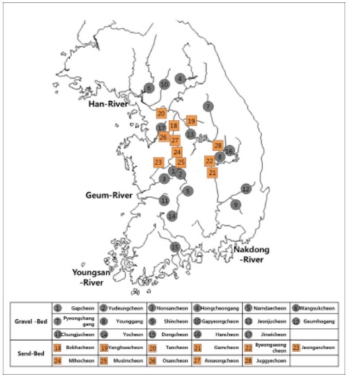
따라서 본 연구에서는 하천을 서식기반으로 살아가는 생물들의 서식공간에 대하여 하천생태학 및 하천지형학에 의하여 분류를 포함한 국내여건에 맞도록 전국단위의 생물서식처 유형을 구분하고 국내 28개 하천을 대상으로 모래하천과 자갈하천으로 나누어 도심구간과 자연하천구간에서 서식처 분포 특성을 분석하였다. 또한 해당하천에서 현장 계측을 통하여 유형구분된 서식처별로 물리적인 구조를 분석함으로써 도심하천에서 생물서식처의 수리적 및 지형적 특성을 분석하였다.
연구 방법 및 범위
연구 대상지
생물서식처의 유형을 구분하기 위하여 전국의 하천 중 하상이 모래로 이루어진 11개 모래하천과 하상이 자갈로 이루어진 17개 자갈하천을 선정하였으며, 각 하천을 다시 자연하천구간과 도심하천구간1)으로 구분하여 서식처 분포를 조사하였다.
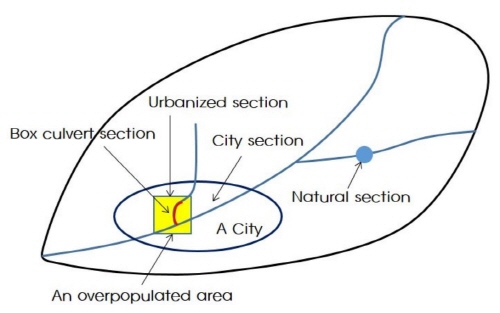
구간 구분 기준 설정
|
Fig. 1. Study Area |
본 연구에서 생물서식처를 하천 전 구간에 대하여 구분하는 것은 불가능하므로 연구대상 범위를 한정하기 위하여 각각의 하천에 대하여 먼저 도심하천구간과 자연하천구간에서 리치 (reach) 단위로 구분한 후, 출현하는 개별 서식처를 구분하였다. 이때 각 구간구분에 대한 기준은 Table 1과 같은 기준으로 구분하였다.
Table 1. Criteria for Urbanized section and Close to nature section |
Urbanized section | Natural section |
-Land use for housing, industries, and commerce surrounding river (in 1 km) -Use of terrace land for amenity, sports and parking lot by demand of local people -Straightened channel section -Simplified river habitat section limited by artificial revetment block -Lowly evaluated section by river environment evaluation (Ⅳ, Ⅴ level) | -Land use for agriculture and mountain surrounding river (in 1 km) -No use of terrace land for artificial purpose (amenity and parking lot) -Meandering channel section -Natural revetment section with sand bars -Highly evaluated section by river environment evaluation (Ⅰ, Ⅱ level) -Conservation area managed by the government |
|
|
Fig. 2. Study Area Urbanized Section Image map |
각 구간별 생물서식처 유형 및 특성분석
생물서식처 유형구분
전국의 하천을 대상으로 생물서식처 유형을 분류하였는데 먼저 도상에서 하천을 구분하고 구간을 선정한 후, 구간별 유형을 구분하였으며 이를 현장조사를 통하여 유형을 확인하는 형태로 이루어졌다. 자갈하천과 모래하천으로 하천특성에 따라 분류한 후, 각 하천을 도심하천구간과 자연하천구간에서 리치 단위로 구분하였다. 각각의 리치에서 하천의 지형적 특성과 수리․수문적 특성을 고려하여 제내지 하천부지인 폐천 및 구하도나 천변저류지 등은 제외하고 제외지 구간 (하도 및 수변부)에서만 생물서식처를 유형 구분하였다.
하천특성 분석
하천유역의 토질은 해당하천의 하천정비기본계획을 바탕으로 비교분석하여 모래하천과 자갈하천의 구분 특성을 비교분석하였고, 하상경사는 해당하천의 하천기본계획에 제시되어있는 최심하상고를 구간별로 추출하여 분석하였다.
서식처 특성분석
각 리치 별로 구분된 각각의 서식처에 대하여 수심, 유속, 하상재료분석 등을 실시하였다.
각각의 서식처에 대한 수심과 유속은 하도와 직각방향으로 1 m 간격으로 측정하였으며, 이때 유속계는 전자유속계 FLO-MATE 2000을 사용하였다.
또한, 개별 하천의 하천정비기본계획서에 명기된 하상재료 자료는 해당하천 전유역에 대한 평균입경을 제시하고 있으므로 각 서식처별로 평수기에 시료를 채취한 후 실험실에서 채분석을 통하여 대표입경 (D50)을 분석하였다.
결과 및 고찰
하도 생물서식처의 유형
모래하천과 자갈하천의 구분
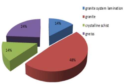
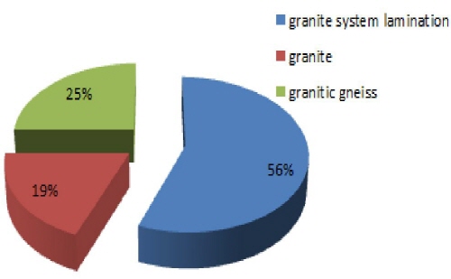
전국의 28개 하천을 대상으로 각 하천의 지질분석결과, 자갈하천의 경우는 화강암 (48 %)과 화강편마암층이 주를 이루고 있으며, 모래하천의 경우 침식되기 쉬운 화강암계충적층이 주를 이루고 있는 것으로 분석되었는데, 이러한 하상재질의 변화는 하상경사에 따라 달리 나타나기도 하지만 지배적인 요인으로는 그 유역의 지질적 차이가 더 큰 요인으로 작용하여 달리 나타나는 것으로 판단된다.
하도 생물서식처 유형구분
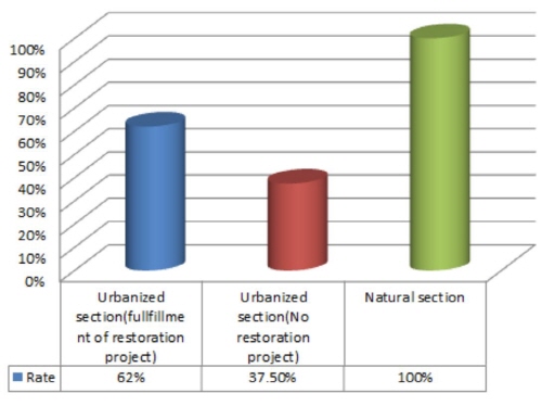
전국의 28개 하천을 대상으로 하도내, 저수, 둔치의 생물서식처 유형을 분류한 결과, 총 16가지 유형의 생물서식유형으로 분류되었다.
도심하천구간의 서식처 유형은 자연하천구간 (16가지유형, 100 %)에 비하여 복원사업 미 수행구간 (6가지유형, 37.5 %), 복원사업구간 (9가지유형, 56.3 %)로 복원사업이 이루어진 구간에서 서식처 유형이 더 많이 나타나는 것으로 분석되었다.
|
|
Fig. 3. Result of soil analysis for study sites (left : gravel bed river, right : sand bed river) |
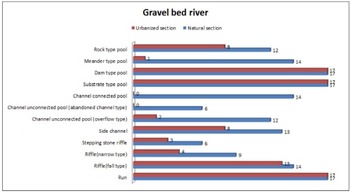
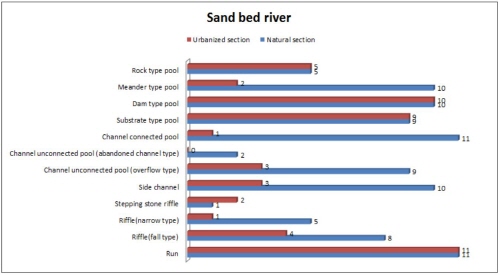
그중 모든 하천에서 나타나는 평여울을 제외하고, 가장 많이 분포하고 있는 서식처 유형은 댐형웅덩이와 낙차형웅덩이로 분석되었는데, 이들 유형은 도심하천구간이나 자연하천구간에서나 모두 분포하는 것으로 조사되었다. 이러한 현상은 과거 농업용 취수를 목적으로 하천에 횡단구조물을 많이 설치하였으며, 도심하천구간에서도 목적이나 기능을 다한 구조물을 제거하거나 철거하기 보다는 개선 및 개량하여 하천구조물로 그대로 활용하고 있다는 것을 반증하는 결과이기도 하다.
또한, 자연하천구간에는 존재하나 도심하천에서는 나타나지 않는 서식처 유형으로는 개방형하도습지로 분석되었다. 이러한 원인으로는 하도의 직강화, 과도한 둔치의 조성으로 기존에 존재하였던 습지를 훼손한 결과로 판단된다.
|
Fig. 4. Rate of Habitat types for each section |
|
|
|
|
Fig. 5. Habitat distribution of gravel and sand bed river |
이와 더불어 모래하천에서 가장 적게 나타나는 서식처유형은 폐쇄형하도습지로 분석되었으며, 그 다음이 징검다리형 여울로 조사되었다. 이러한 원인으로 모래하천이 유사의 이동과 공급이 심하기 때문에 이러한 서식처가 유지되기 힘들기 때문으로 판단되며, 모래하천에서 이러한 서식처를 조성하기 위해서는 유사의 공급과 차단을 고려한 계획 및 설계가 이루어져야 할 것으로 판단된다.
반면, 자갈하천의 경우 가장 적게 나타나는 서식처유형은 폐쇄형하도습지 (구하도형)로 분석되었다. 이러한 원인으로는 홍수에 의해 교란이 발생되더라도 주 물길이 쉽게 변하지 않는 자갈하천의 특성에도 기인하지만, 홍수시 자유롭게 범람할 수 있는 둔치 공간을 축소시켜온 잘못된 하천관리와도 관계가 있는 것으로 판단된다.
또한, 사주부에 나타나는 식생군락의 형태도 자연하천구간에서는 초본, 관목, 교목의 다양한 계층구조를 가지고 있는 반면, 도심하천에서는 단순한 인공수림대 (초본+갯버들)로 형성되어있다.
Table 2. Habitat distribution of Urbanized section and Natural section |
| | Urbanized Section | Natural Section |
No restoration project | Fulfillment of river restoration project |
Habitat Types | In-stream | Run, Riffle (fall type), Substrate type pool, Dam type pool | Run, Riffle (fall type), Stepping stone riffle, Channel unconnected pool (overflow type), Side channel, River island, Substrate type pool, Dam type pool | Run, Riffle (fall type), Riffle (narrow type), Stepping stone riffle, Side channel, Channel unconnected pool (overflow type), Channel unconnected pool (abandoned channel type), Channel connected pool, Substrate type pool, Dam type pool, Meander type pool, Rock type pool, River island |
Low flow and terrace land | Herbaceous plants zone, Shrub plants zone | Artificial planting zone of herbaceous plant, Artificial planting zone of shrub plant | Herbaceous plants zone, Shrub plants zone, Tree plants zone |
생물서식처의 수리 및 지형학적 특성분석
하천에서의 생물서식처는 홍수나 증수와 같은 자연적 교란에 의하여 형성되어진다. 따라서 서식처의 유형은 수리 및 지형적 특징을 그대로 반영하고 있다고 할 수 있다.
특히, 폐쇄형하도습지 (범람형)가 수리적인 영향에 의존하고 있는 대표적인 예라고 할 수 있다. 폐쇄형하도습지 (범람형)는 대규모 홍수 발생시 제방이나 주변 산지 하단부 세굴에 의하여 형성되는 습지이기 때문에 홍수가 발생되어야만 유량을 공급받게 되어있는 형태의 서식처이다. 반면 개방형하도습지는 본천과 연결되어있어 본류로부터 상시 유량을 공급받을 수 있는 구조로서 폐쇄형하도습지 (범람형)과는 구분되는 서식처라 할 수 있다. 따라서 이러한 유형 분류된 서식처별 수리 및 지형학적 특성을 Table 3과 같이 분석하였다.
Table 3. Instream habitat types and hydraulic/geomorphological characteristics |
Habitat types | Hydraulic/Geomorphological characteristics |
Bed material (D50/mm) | Disturbance frequency (per year) | Average water depth (cm) | Average flow velocity (m/s) |
Run | 
| -Formed where river width expand by sudden geomorphological change or straight section of meandering river -Little water waves as looks like no flow |
Sand bed river | 1.0-2.0 | Ordinary | 30-40 | 0.05-0.25 |
Gravel bed river | 15-20 | Ordinary | 50-60 | 0.30-1.00 |
Riffle (narrow type) | 
| -Formed where river width sharply narrows to lead flow velocity increased like a valley -Coarse river bed material relatively compare to other habitat types -Identified water waves and intensive water energy |
Sand bed river | 10-30 | Ordinary | 30-40 | 0.50-0.60 |
Gravel bed river | 35-50 | Ordinary | 60-70 | 0.60-0.70 |
Riffle (fall type) | 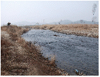
| -Formed where river bed elevation sharply differs between upstream and downstream -Formed across the whole river width with partial intensive water energy -Smaller river bed material than narrow type riffle -Identified water waves |
Sand bed river | 30-40 | Ordinary | 10-30 | 0.05-0.70 |
Gravel bed river | 30-40 | Ordinary | 10-20 | 0.45-0.75 |
Stepping stone riffle | 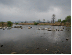
| -Formed where several natural rocks remains together with reduction of cross-sectional area of flow to lead flow velocity fast -Low water depth and faster flow velocity than surrounding -Providing temporary refuge for fish by several small pools and habitat for attached benthic organism with relatively fast flow velocity |
Sand bed river | 1.0-5.0 | Ordinary | 20-30 | 0.30-0.40 |
Gravel bed river | 1.0-10.0 | Ordinary | 20-35 | 0.10-0.30 |
Side channel | 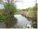
| -Formed separately from main channel -Artificially formed to increase flood flow capacity and for habitat -Necessary to consider discharge allocation, separation point and method to decide channel scale (width, height etc.) |
Sand bed river | 2.0-3.0 | Ordinary | 30-50 | 0.10-0.30 |
Gravel bed river | 1.0-10.0 | Ordinary | 30-50 | 0.30-1.00 |
Table 3. Continued |
Habitat types | Hydraulic/Geomorphological characteristics |
Bed material (D50/mm) | Disturbance frequency (per year) | Average water depth (cm) | Average flow velocity (m/s) |
Channel unconnected pool (overflow type) | 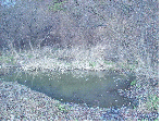
| -Formed when large scale flood occurs in lower section of bank or near mountains -Frequency of connection to main stream depends on the flow regime -Water supplied by overflow in flood season, and the number of fish and productivity differed by the frequency of connection to main stream -The form as like pit with deposition of supplied sediment, and deteriorated water quality with eutrophication -Habitat for reptiles and amphibians |
Sand bed river | 0.01-0.03 | 1-2 | 20-40 | 0 |
Gravel bed river | 0.1-1.0 | 1-2 | 50-80 | 0 |
Channel unconnected pool (abandoned channel type) | 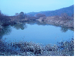
| -Instream oxbow separately formed by river channel short cut -Separated from main stream in usual, and water supplied from underground flow unlikely with overflow type -Temporary refuge for fry in flood but carnivorous fish or exotic fish tending to dominate the pool because of separation from main stream |
Sand bed river | 0.1-1.0 | 1-2 | 50-80 | 0 |
Gravel bed river | 0.2-10.0 | 1-2 | 60-170 | 0 |
Channel connected pool | 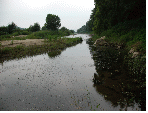
| -Formed in inside of meander section, dead area of flow, or end point of sandbar -Low water depth and low flow velocity, and formed deeply toward to land -Habitat for fry, specific fish, and benthic organism with slow water flow -Connected to main channel allowing organism migration -Water supplied from main stream and underground flow, so water quality same as main stream or relatively better |
Sand bed river | 0.2-0.5 | Ordinary | 20-40 | 0-0.2 |
Gravel bed river | 0.2-1.0 | Ordinary | 40-70 | 0.05-0.40 |
Dam type pool | 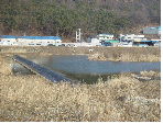
| -Formed where transverse structure such as weir and drop structure is constructed with storing water -Run in upstream of transverse structure with uncertain boundary of pool which depend on water depth, flow velocity, river bed material -Boundary of dam type pool up to upstream riffle in general opinion |
Sand bed river | 0.05-1.0 | Ordinary | 50-100 | 0.05-0.3 |
Gravel bed river | 1.0-2.0 | Ordinary | 50-100 | 0.2-0.5 |
Substrate type pool | 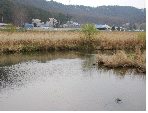
| -Formed where flow drops and concentrates by bedrock, drop structure, or weir resulting bed material changes -Tendency to formed substrate type pool with run consecutively in upstream toward downstream -Deposition of eroded sediment by flood in downstream |
Sand bed river | 0.3-5.0 | Ordinary | 40-60 | 0.3-0.6 |
Gravel bed river | 0.5-5.0 | Ordinary | 60-100 | 0-1.0 |
Table 3. Continued |
Habitat types | Hydraulic/Geomorphological characteristics |
Bed material (D50/mm) | Disturbance frequency (per year) | Average water depth (cm) | Average flow velocity (m/s) |
Rock type pool | 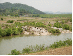
| -Formed near bedrock, rock or bridge by erosion of water flow -Deeper water depth than other pools caused by relatively higher water velocity -Difficult to maintain the pool unless artificial scour protection is installed -Carnivorous fish, exotic fish, or high swimming force fish tending to dominate the pool |
Sand bed river | 0.1-2.0 | Ordinary | 50-70 | 0.2-0.4 |
Gravel bed river | 1.0-5.0 | Ordinary | 60-100 | 0.2-0.7 |
Meander type pool | 
| -Formed where the water impact area is dug deep by meandering water flow -Formed even in straight channel with meandering flow channel -Emergence of riffle with water wave in upstream making easy to distinguish -Emergence of run in downstream of the pool in many cases |
Sand bed river | 0.5-1.0 | Ordinary | 40-50 | 0.2-0.4 |
Gravel bed river | 1.0-5.0 | Ordinary | 40-70 | 0.2-0.7 |
River island | 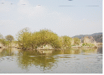
| -Formed in middle of channel by deposition of sediment as an island -Expanding the scale of river island by conditions of sediment supply and settled vegetation in flood season -Progression of riparian vegetation succession from herbaceous and shrub plants to tree plants caused by flow regime changes such as flooding frequency, flow velocity, soil moisture content, underground flow difference of elevation, and distance or elevation difference from shoreline |
Sand bed river | 2.0-3.0 | Ordinary | - | - |
Gravel bed river | 1.0-10.0 | Ordinary | - | - |
|
Table 4. Riverside land habitat types and geomorphological characteristics |
Habitat types | Hydraulic/Geomorphological characteristics |
Artificial planting zone | 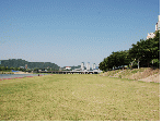
| -Artificial planting area in low flow zone and terrace land -Implementation of artificial planting in most of urban stream with Salix gracilistyla for low flow zone and lawn grass for terrace land |
Tree plants zone | 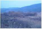
| -Forestation area of tree plants in inside of meandering channel with little water flow in flood season -Form vegetation colony with Salix nipponica, Salix glandulosa in most cases, and Zelkova serrata in some cases |
Table 4. Continued |
Habitat types | Hydraulic/Geomorphological characteristics |
Shrub plants zone | 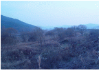
| -Shrub vegetation colony zone -Dominated by Salix gracilistyla near shoreline and by Spiraea prunifolia var. simpliciflora and Lespedeza bicolor near bank in many cases |
Herbaceous plants zone | 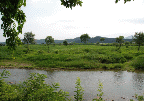
| -Vegetation belt near shoreline with dominant influence from geomorphology and flow velocity -Dominated by Phragmites japonica in upstream with high flow velocity, by Phragmites communis in middle and down stream with relatively slow flow velocity, and by Zizania latifolia in lentic water -Dominated by Miscanthus sacchariflorus with higher elevation in lateral direction of river in some cases |
결론 및 시사점
본 연구는 국내 28개 하천을 대상으로 인위적인 훼손이 상대적으로 적은 자연하천구간과 인공적으로 정비된 도심하천구간에서 나타나는 생물서식처 유형을 비교분석하고, 하천복원에 생물서식처 조성형태를 제시하는 기초적 연구로서, 국내하천을 하천특성에 따라 모래하천과 자갈하천으로 구분하고, 각각의 서식유형을 비교 검토하였으며 그 결과는 다음과 같다.
(1) 유형구분 분석결과, 자연하천구간에서는 총 16개 유형, 하천복원사업 시행구간에서는 9개 유형, 미시행구간에서는 6개 유형으로 분류되었다.
(2) 기존에 하천정비사업은 이루어졌지만 하천복원사업이 아직 진행되지 않은 도심구간은 자연하천구간의 생물서식처 유형과 비교하면 불과 약 37.5 % 정도의 매우 단순한 형태의 서식처만이 존재하고 있는 것으로 분석되어 건전한 하천생태계의 보전 및 복원을 위해서는 보다 다양한 형태의 생물서식처복원이 필요한 것으로 판단되었다.
(3) 급여울은 크게 단차형과 협곡형으로 구분되어졌는데, 부분적인 하상경사의 차이에서 발생하는 단차형은 폭넓게 여울이 형성되는 형태인 것에 반하여, 협곡형은 암반이나 사주형성에 의해 주수로폭이 좁아져서 나타나는 형태로 구분되었으며, 협곡형이 단차형보다 수심도 깊고 유속도 빠르며, 상대적으로 하상재료도 큰 형태의 서식처 유형으로 분석되었다.
(4) 제내지의 폐천 및 구하도나 저류지형태의 습지와 차별되는 하도내에 분포하는 물이 고여 있는 형태의 습지로는 폐쇄형하도습지 (범람형), 폐쇄형하도습지 (구하도형), 개방형하도습지로 구분되었다.
(5) 하중도의 경우, 도심하천구간에서는 28개하천 중 11개 하천에서만 나타나 (인공으로 조성된 하중도 포함, 자연하천구간에서는 26개 하천 출현) 하천정비시 병행되는 하도준설 및 평탄화에 의해 서식처가 훼손되고 있는 것으로 판단되며, 생태하천조성시 적극적인 보전대책이 필요한 것으로 판단된다.
(6) 자갈하천의 경우 가장 적게 나타나는 서식처유형은 폐쇄형하도습지 (구하도형)로 분석되었는데, 이는 홍수에 의해 교란이 발생되더라도 주 물길이 쉽게 변하지 않는 자갈하천의 특성에도 기인하지만, 홍수시 자유롭게 범람할 수 있는 둔치 공간을 축소시켜온 잘못된 하천관리와도 관계가 있는 것으로 판단된다.
(7) 개방형하도습지는 도심하천에서는 전혀 나타나지 않아 그간 관행적으로 이루어진 하천정비에 의한 저수로공사에 기인한 것으로 판단되며, 이동성이 높은 어류를 대상으로 산란 및 은폐를 위한 서식처를 복원할 경우 이러한 형태의 서식처조성이 필요한 것으로 판단된다.
(8) 자연하천구간에서는 초본, 관목, 교목의 다양한 계층구조를 가지고 있는 반면, 도심하천에서는 예외 없이 인공수림대 (초본+갯버들)로 형성되어있어 생태적인 측면보다 치수측면을 우선한 도심부 하천관리에 기인하는 것으로 판단된다.
도심하천 구간은 자연하천구간과 비교하여, 저수로의 직강화로 다양한 형태의 여울, 습지, 하중도 등이 사라졌고, 고수부 평탄화로 단순한 인공식재지가 도입되는 등 생물들이 서식할 수 있는 기반환경이 훼손 및 감소되어 있어 하천환경복원사업이 지속적이며 시급히 이루어져야 할 것으로 판단된다.
향후, 서식처 유형별 생물 특성에 대한 정밀한 조사를 토대로 한 하도생물서식처 조성에 대한 연구가 더욱 활발히 진행되어야 할 것으로 판단된다.
부록 1. 하천별 서식처유형 분포특성 |
번호 | 지명 | 하천명 | 유 역 개 황 | 서식처 유형분류 |
유형 구분 | 유역 면적 (㎢) | 유로 연장 (㎞) | 하폭 (m) | 저수 로폭 (m) | 서식처유형구분 조사구간 | 하상 경사 | 급여울 (협곡형) | 급여울 (단차형) | 평여울 | 징검 다리형 여울 | 샛강 | 하중도 | 폐쇄형 하도 습지 (범람형) | 폐쇄형 하도 습지 (구하 도형) | 개방형 하도 습지 | 낙차형 웅덩이 | 댐형 웅덩이 | 사행형 웅덩이 | 거석형 웅덩이 |
1 | 대전 | 갑천 | 자갈 | 648 | 73.7 | 200 ~300 | 10 ~200 | 자연 | 만년교 상류 1km지점 ~ 가수원교 (약3km) 구간 | 1/600 | ○ | | ○ | ○ | ○ | ○ | ○ | ○ | ○ | ○ | ○ | ○ | |
도심 | 유성천합류부 ~ 법동천합류부 (약1km) 구간 | 1/700 | | | ○ | | | | | | | ○ | ○ | | |
2 | 대전 | 유등천 | 자갈 | 123 | 29.85 | 50 ~200 | 10 ~100 | 자연 | 지량1교 상류500m ~ 지량1교 하류2km 구간 | 1/150 ~1/300 | ○ | ○ | ○ | ○ | ○ | ○ | | | ○ | ○ | ○ | ○ | ○ |
도심 | 버드내교 상하류 300m 구간 | ○ | ○ | ○ | | ○ | ○ | | | | ○ | ○ | | ○ |
3 | 논산 | 논산천 | 자갈 | 665 | 57.10 | 150 ~300 | 30 ~180 | 자연 | 탑정호 직하류 ~ 하류방향 3km 구간 | 1/500 | | ○ | ○ | | ○ | ○ | ○ | ○ | ○ | ○ | ○ | ○ | ○ |
도심 | 논산대교 직상하류 200m 구간 | | ○ | ○ | | | | | | | ○ | | | |
4 | 홍천 | 홍천강 | 자갈 | 1,566 | 140.2 | 100 ~250 | 50 ~150 | 자연 | 철정교 ~ 주음치1교 구간 | 1/800 | | ○ | ○ | ○ | ○ | ○ | ○ | | ○ | ○ | ○ | ○ | ○ |
도심 | 남산교~홍천교 구간 | ○ | | ○ | | | | | | | ○ | ○ | | |
5 | 무주 | 남대천 | 자갈 | 464 | 53 | 120 ~150 | 30 ~110 | 자연 | 하장백교 하류방향 약 2.3km 구간 | 1/250 | ○ | ○ | ○ | ○ | ○ | ○ | ○ | | ○ | ○ | ○ | ○ | ○ |
도심 | 무주대교 ~ 무주교 구간 | | | ○ | | | | | | | ○ | ○ | | ○ |
6 | 남양주 | 왕숙천 | 자갈 | 277 | 37 | 100 ~200 | 40 ~150 | 자연 | 임송교 상류 900m ~ 임송교 하류 400m 구간 | 1/80 ~1/170 | | ○ | ○ | ○ | ○ | ○ | ○ | | ○ | ○ | ○ | ○ | ○ |
도심 | 왕숙천교 상류 100m ~ 왕숙천교 하류 800m구간 | | ○ | ○ | | | | | | | ○ | ○ | | ○ |
7 | 평창 | 평창강 | 자갈 | 1,781 | 149 | 100 ~200 | 50 ~150 | 자연 | 여만교 하류 500m ~ 평창교 구간 | 1/300 | ○ | ○ | ○ | | ○ | ○ | | | ○ | ○ | ○ | ○ | ○ |
도심 | 평창교 상류 700m ~ 평창교 하류 300m 구간 | | ○ | ○ | | | | | | | ○ | ○ | | ○ |
8 | 문경 | 영강 | 자갈 | 922 | 68.4 | 100 ~300 | 50 ~200 | 자연 | 영순교 ~ 영순교 하류 2km 구간 | 1/450 ~1/1,040 | | ○ | ○ | | ○ | ○ | ○ | | ○ | ○ | ○ | ○ | ○ |
도심 | 영강대교 ~ 신영강교 (약1km) 구간 | | ○ | ○ | | ○ | ○ | | | | ○ | ○ | | ○ |
9 | 대구 | 신천 | 자갈 | 159 | 28 | 100 ~150 | 50 ~70 | 도심 | 동신교 ~ 성북교 하류 300m 구간 | 1/121 ~1/714 | | ○ | ○ | ○ | | | | | ○ | ○ | ○ | | ○ |
10 | 가평 | 가평천 | 자갈 | 307 | 37.5 | 70 ~150 | 30 ~80 | 자연 | 승안천 합류부 ~ 승안천 합류부 상방 1.5km구간 | 1/225 | ○ | ○ | ○ | | | ○ | ○ | ○ | ○ | ○ | ○ | | |
도심 | 가평교 상류 700m ~ 가평교 하류 300m 구간 | 1/320 | | ○ | ○ | | ○ | ○ | | | ○ | | | | |
11 | 전주 | 전주천 | 자갈 | 280 | 32.5 | 70 ~100 | 10 ~50 | 자연 | 은석교 상류 300m ~ 한벽교 구간 | 1/170 ~1/230 | ○ | ○ | ○ | | | ○ | | | ○ | ○ | ○ | ○ | ○ |
도심 | 완산교 ~ 건산천 합류부 구간 | ○ | ○ | ○ | | | | | ○ | ○ | ○ | ○ | | |
12 | 영천 | 금호강 | 자갈 | 2,053 | 116 | 200 ~300 | 50 ~150 | 자연 | 영록교 상류 500m ~ 영록교 하류 1km 구간 | 1/700 | | ○ | ○ | | ○ | ○ | ○ | | ○ | ○ | ○ | ○ | ○ |
도심 | 영화교 하류 300m ~ 영천교 구간 | | ○ | ○ | | ○ | | | | | ○ | ○ | | ○ |
13 | 충주 | 충주천 | 자갈 | 43 | 11.36 | 50 ~150 | 20 ~80 | 자연 | 상방교 상류 100m ~ 하방교 상류 200m 구간 | 1/600 | | ○ | ○ | | ○ | ○ | ○ | | | ○ | ○ | | ○ |
도심 | 대봉교 ~ 삼원교 구간 | 1/200 | | ○ | ○ | | ○ | ○ | | | | ○ | ○ | | |
14 | 남원 | 요천 | 자갈 | 4,897 | 218.6 | 100 ~200 | 30 ~150 | 자연 | 주촌천 합류부 ~ 광치천 합류부 하류 1km 구간 | 1/100 | ○ | ○ | ○ | ○ | ○ | ○ | ○ | | ○ | ○ | ○ | ○ | ○ |
도심 | 승사교 상류 200m ~ 승사교 하류 800m 구간 | 1/130 | ○ | ○ | ○ | ○ | ○ | ○ | | | ○ | ○ | ○ | ○ | ○ |
15 | 순천 | 동천 | 자갈 | 371 | 27.8 | 100 ~200 | 30 ~100 | 자연 | 동천교 하류 700m ~ 순천문학관 구간 | 1/2,000 | ○ | ○ | | | | ○ | ○ | ○ | | ○ | ○ | ○ | |
도심 | 풍덕교 ~ 풍덕교 하류 500m 구간 | 1/700 | | | ○ | ○ | | ○ | | | | ○ | ○ | | |
16 | 예천 | 한천 | 자갈 | 266 | 33.4 | 60 ~100 | 30 ~80 | 자연 | 생천교 상류 1.5km ~ 한천교 구간 | 1/400 | | ○ | ○ | | ○ | ○ | ○ | | ○ | ○ | ○ | ○ | ○ |
도심 | 동본교 상류 100m ~ 예천교 상류 300m 구간 | | ○ | ○ | | ○ | | | | | ○ | ○ | | ○ |
17 | 평택 | 진위천 | 자갈 | 204 | 32 | 70 ~180 | 20 ~90 | 자연 | 진목교 상류 100m ~ 세월교 상류 250m 구간 | 1/1,500 | ○ | ○ | ○ | | ○ | ○ | | ○ | ○ | ○ | ○ | ○ | |
도심 | 봉남교 ~ 봉남교 하류 1.4km 구간 | | | ○ | | ○ | ○ | | | | ○ | ○ | | |
18 | 여주 | 복하천 | 모래 | 309 | 38.5 | 50 ~200 | 30 ~80 | 자연 | 홍천교 ~ 귀백2교 구간 | 1/940 | | ○ | ○ | ○ | ○ | ○ | ○ | ○ | ○ | | | ○ | ○ |
도심 | 복하교 하류 300m ~ 복하교 상류 700m 구간 | 1/850 | | ○ | | | | | | | | ○ | ○ | | ○ |
19 | 여주 | 양화천 | 모래 | 184 | 33.2 | 50 ~200 | 10 ~130 | 자연 | 율극교 직상류 하류방향 약 2.5km 구간 | 1/550 | | ○ | ○ | | ○ | ○ | ○ | | ○ | ○ | ○ | ○ | |
도심 | 장평교 직하류 약 500m 구간 | 1/1,100 | | | ○ | | | | | | | ○ | ○ | | |
20 | 성남 | 탄천 | 모래 | 302 | 35.6 | 150 ~250 | 50 ~80 | 자연 | 대왕교~탄천1교 구간 | 1/1,000 | ○ | | ○ | | ○ | | ○ | | ○ | ○ | ○ | ○ | ○ |
도심 | 대왕교 상류방향 약 4km 구간 | 1/750 | | | ○ | | | | ○ | | | ○ | ○ | | |
21 | 김천 | 감천 | 모래 | 1,000 | 69 | 150 ~200 | 25 ~100 | 자연 | 구마교~장암교 구간 | 1/650 | | ○ | ○ | | ○ | ○ | ○ | ○ | ○ | ○ | ○ | ○ | ○ |
도심 | 김천교 상류방향 약 1km 구간 | 1/950 | | | ○ | | | | | | | ○ | ○ | | ○ |
22 | 상주 | 병성천 | 모래 | 422 | 32.3 | 150 ~300 | 10 ~100 | 자연 | 병성교 ~ 동천 합류부 하류 800m 구간 | 1/900 | | ○ | ○ | | ○ | ○ | ○ | | ○ | ○ | ○ | ○ | ○ |
도심 | 후천교 상류 250m ~ 후천교 하류 250m 구간 | | | ○ | | | ○ | | | | ○ | ○ | | ○ |
23 | 공주 | 정안천 | 모래 | 161 | 29.56 | 150 ~200 | 30 ~120 | 자연 | 보물교 ~ 두만천 합류부 구간 | 1/600 | | ○ | ○ | | ○ | ○ | ○ | | ○ | ○ | ○ | ○ | |
도심 | 정안천교 하류 500m 구간 | | | ○ | | | | | | | ○ | ○ | | |
24 | 증평 | 미호천 | 모래 | 1,853 | 89.2 | 100 ~400 | 30 ~250 | 자연 | 은탄교 상류 1.3km ~ 팔결교 하류 200m 구간 | 1/600 | ○ | ○ | ○ | | ○ | ○ | ○ | | ○ | ○ | ○ | ○ | ○ |
도심 | 보롬교 상류 500m ~ 보롬교 하류 500m 구간 | | | ○ | | | | | | ○ | | | | |
25 | 청주 | 무심천 | 모래 | 193 | 32.4 | 100 ~200 | 20 ~100 | 자연 | 노동교 하류 1km ~ 노동교 하류 3km 구간 | 1/500 | ○ | | ○ | | ○ | ○ | | | ○ | ○ | ○ | | |
도심 | 남사교 ~ 송천교 하류 2km 구간 | 1/720 | ○ | | ○ | | ○ | ○ | | | ○ | ○ | ○ | ○ | ○ |
26 | 오산 | 오산천 | 모래 | 59 | 15.35 | 80 ~150 | 10 ~60 | 자연 | 잠수교 하류 400m ~ 금암교 구간 | 1/600 | ○ | ○ | | | ○ | ○ | ○ | | ○ | | | ○ | |
도심 | 금오대교 ~ 남촌대교 구간 | | ○ | ○ | ○ | ○ | ○ | ○ | | | ○ | ○ | ○ | |
27 | 안성 | 안성천 | 모래 | 1674 | 58.2 | 80 ~150 | 10 ~100 | 자연 | 한천 합류부 ~ 안성천2교 하류 800m 구간 | 1/700 | | | ○ | | ○ | ○ | ○ | | ○ | ○ | ○ | ○ | |
도심 | 옥천교 ~ 안성대교 하류 1km 구간 | 1/550 | | ○ | ○ | | ○ | ○ | | | | ○ | ○ | | |
28 | 영주 | 죽계천 | 모래 | 159 | 20.8 | 50 ~200 | 30 ~150 | 자연 | 직서교 하류 1.5km ~ 월호교 구간 | 1/500 | | ○ | ○ | ○ | | | ○ | | ○ | ○ | ○ | ○ | |
도심 | 영주교 상류 100m ~ 영주교 하류 700m | ○ | ○ | ○ | | | | | | | ○ | ○ | | ○ |
1) 도심하천 : 「하천법」 (국가하천 및 지방하천)과 「소하천정비법」 (소하천)에 의해 지정된 하천으로써, 「국토계획 및 이용에 관한 법률」에 의한 행정구역상 도시지역을 흐르는 하천 중 도심구간을 흐르는 하천을 말한다. 일반적으로 도심하천의 경우 유역이 작아서 토지이용이 단순하며, 국지적인 집중호우 시 직강하 형태로 인해 홍수도달시간이 짧아 극심한 피해가 발생한다. 또한, 불투수면의 증가로 침투수량이 감소하고 하수로의 정비로 인해 평상시 수량이 감소하며 생활오수의 유입에 의해 수질이 악화되는 특징을 가지고 있다 (MLIT, 2010).


